Worcs & Glos 1884 Central N Worcs page 44 upper ce…
Worcs & Glos 1884 Central S Glos page 45 lower cen…
Worcs & Glos 1884 Central S Worcs page 44 lower ce…
Worcs & Glos 1884 East Glos page 45 upper right
Worcs & Glos 1884 n-e page 44 up right
Worcs & Glos 1884 n-w page 44 up left
Worcs & Glos 1884 SE Glos page 45 lower right
Worcs & Glos 1884 SE Worcs NE Glos page 44 lower r…
Worcs & Glos 1884 SW Glos page 45 lower left
Worcs & Glos 1884 SW Worcs NW Glos page 44 lower l…
Worcs & Glos 1884 West Glos page 45 upper left
No longer a chequer board - more a bit of a mesh
August Bank Holiday - Seaford - 2013
Lilies in Saint Peter's Churchyard - Happy Easter…
Pascal Candle - Saint Clement's East Dulwich
Wheels - Eastbourne - 12.9.2013
radial grads paint daubs sparkle orange cyan & blu…
Grads and spheres Happy Birthday
Mediaslap - beautiful bug*ers brushes
A dot on the horizon - a wisp of vapour - Seaford…
The ferry leaving Newhaven for Dieppe - 28.11.2015
Leaving Newhaven for Dieppe 28 11 2015
Redshank at Tidemills 28 11 2015
yet more Photoshoppery
more Photoshoppery developed & framed
more Photoshoppery
Floral display on basket background
Every crayon in the box
Not as symmetrical as it seems at first
Angle spectrum - distort:wave - Happy Birthday
angle spectrum - wave - glass buttons
check pattern with multicolour glass buttons
Colour for colour's sake
pages of colour
multi doughnut HB
Marbles should be round
a quilter's nightmare
A bit too far really - but I carried on to the 'St…
Lilac & coral tracery - Best Wishes
Stick a twig on top and it looks OK
I seem to have acquired a shoe fetish
frou-frou
A bit late for halloween
West Bay Newhaven - 18.11.2015
Surfing in West Bay Newhaven - 18.11.2015
Keywords
Authorizations, license
-
Visible by: Everyone -
All rights reserved
-
276 visits
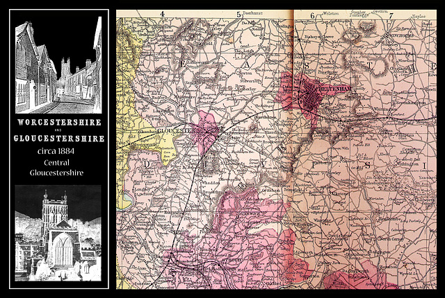
Worcs & Glos 1884 Central Glos page 45 centre


This map is a section of the pages devoted to Worcestershire and Gloucestershire, from a Gazetteer of Great Britain. It has been dated, from the state of development of the railways, to circa 1884. The covers, initial few pages and all of the Welsh section are missing, hence the need to calculate its date. The maps have been uploaded at a large scale, so that they can be seen in detail. Go to ACTIONS and See all sizes. They may take a time to load clearly. I haven't added the whole set to the Gloucestershire group, but they can be found in my Victorian maps album. The sections are a bit odd as the two counties are individually quite odd shapes and even combined they have bits sticking out in odd places.
I haven't scanned Herefordshire, but could do if there is interest.
I haven't scanned Herefordshire, but could do if there is interest.
- Keyboard shortcuts:
Jump to top
RSS feed- Latest comments - Subscribe to the comment feeds of this photo
- ipernity © 2007-2025
- Help & Contact
|
Club news
|
About ipernity
|
History |
ipernity Club & Prices |
Guide of good conduct
Donate | Group guidelines | Privacy policy | Terms of use | Statutes | In memoria -
Facebook
Twitter

Phil Sutters club has replied to MikeinlagardetteSign-in to write a comment.