Location
Lat, Lng: 41.685403, -117.252409
You can copy the above to your favourite mapping app.
Address: unknown
You can copy the above to your favourite mapping app.
Address: unknown
See also...
See more...Keywords
Authorizations, license
-
Visible by: Everyone -
All rights reserved
-
520 visits
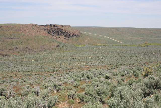
Greeley Crossing


Down in the drainage, where the road crosses the North Fork of the Little Humboldt River, which is emerging from the canyon to the left. In extreme northern Nevada, maybe 20 miles from the Oregon line. As far as I've been able to determine, this was an old stage route, probably from Boise, Idaho to connect to the transcontinental railroad at Winnemucca, Nevada. It's now a graded (not paved!) county road. The white spot just to the right of the canyon mouth is the roof of an abandoned shed. The insert was taken from below the canyon, looking up. There was even running water this early in the season!
Daniel Palacin, , William Sutherland have particularly liked this photo
- Keyboard shortcuts:
Jump to top
RSS feed- Latest comments - Subscribe to the comment feeds of this photo
- ipernity © 2007-2025
- Help & Contact
|
Club news
|
About ipernity
|
History |
ipernity Club & Prices |
Guide of good conduct
Donate | Group guidelines | Privacy policy | Terms of use | Statutes | In memoria -
Facebook
Twitter


Admired in:
www.ipernity.com/group/tolerance
slgwv club has replied to William Sutherland clubSign-in to write a comment.