Location
Lat, Lng: 39.261225, -117.738174
You can copy the above to your favourite mapping app.
Address: State Route 722, Fallon, Nevada, 89406
You can copy the above to your favourite mapping app.
Address: State Route 722, Fallon, Nevada, 89406
See also...
See more...Keywords
Authorizations, license
-
Visible by: Everyone -
All rights reserved
-
616 visits
Aftermath


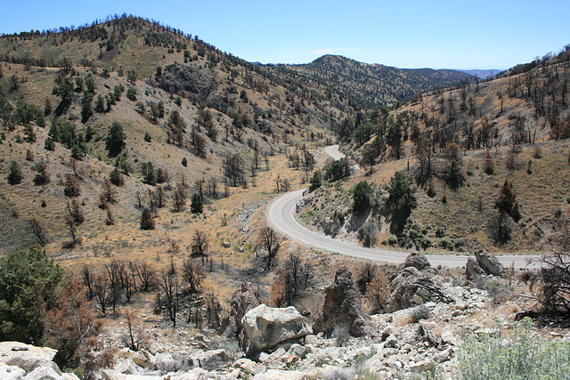
Burned trees from the Cold Springs wildfire, started by lightning in August 2015. In the Desatoya Mountains, Nevada, just west of Desatoya summit, on Nevada SR 722 (old US 50). Looking south. This was one they were just going to let burn out--it was caused naturally, and initially wasn't threatening structures--but it got out of hand.
Smiley Derleth has particularly liked this photo
- Keyboard shortcuts:
Jump to top
RSS feed- Latest comments - Subscribe to the comment feeds of this photo
- ipernity © 2007-2025
- Help & Contact
|
Club news
|
About ipernity
|
History |
ipernity Club & Prices |
Guide of good conduct
Donate | Group guidelines | Privacy policy | Terms of use | Statutes | In memoria -
Facebook
Twitter


Sign-in to write a comment.