Ron's Log's photos with the keyword: satellite
Moop Map 9-29-14 (small version)
| 30 Sep 2014 |
|
The date at the top (9.20.14) is from an earlier version of this map and should be a date closer to Sept. 29, 2014.
Full size available this link .
Official map available at blog.burningman.com/wp-content/uploads/2014/09/MOOP-MAP-2014_DAY-6_3500w.gif
Vernon Civic Center & Residential District
| 05 Aug 2014 |
|
70555 Thunderbird Mesa Dr Rancho Mirage CA 92270
Thunderbird Estates
| 22 Jul 2014 |
|
Burning Man 2012 Satellite Photo
| 07 Sep 2012 |
|
|
The original hi-res photo is available here . I've encircled our camp and friendly neighbors on this image.
Burning Man Satellite August 31 (partial)
| 26 Jul 2012 |
|
It looks like a night image, but it's actually a radar image with false colors. This is part of an image from five images on this site .
2011 Satellite photo of our camp
| 07 Sep 2011 |
|
4:15 and Journey is the intersection in the upper right. This is cropped from the original 12 MB satellite photo available from t.co/zqQAywZ
According to Burning Man's new rules, all photos from Burning Man must be restricted to friends or family.
Painted Hills Middle School satellite view
| 04 Jul 2010 |
|
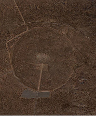
Trinity Site Satellite View
| 06 Apr 2010 |
|
Corona Yacht Club
DHS Civic Center
| 11 Feb 2010 |
|
Whitewater to DHS
| 27 Jan 2009 |
|
Mono Lake to Los Angeles
| 24 Jul 2008 |
|
Mission Creek Fault in DHS
Jump to top
RSS feed- Ron's Log's latest photos with "satellite" - Photos
- ipernity © 2007-2025
- Help & Contact
|
Club news
|
About ipernity
|
History |
ipernity Club & Prices |
Guide of good conduct
Donate | Group guidelines | Privacy policy | Terms of use | Statutes | In memoria -
Facebook
Twitter


