Berny's photos with the keyword: erosion
Cima Presanella (3556 m)
| 25 Jan 2022 |
|
|
|
View to Cima Presanella from SS42, the west ramp of Passo Tonale. - scanned slide, Minolta X700
Ruta 41 - Pico Triangular Sur
| 16 Nov 2021 |
|
|
|
Pico Triangular Sur is the Andes mountain in the background (2588 m), situated on the border between Argentina and Chile. Rio El Zeballos flows below the nice geological formation. - scanned slide, Minolta X700
The two PiP's are photos made in 2015 from the same view point.
sculptures - 2
Talampaya Gorge - the wall
| 04 Sep 2021 |
|
|
|
The slot and the walls are about 145 m high.
scanned slide, Minolta X700
Talampaya Gorge - looking up
Talampaya Gorge - erosion
| 04 Sep 2021 |
|
|
|
This is the view point for the next two images, looking up the erosion slot.
scanned slide, Minolta X700
Grand Canyon - Mather Point - 1986
| 19 Mar 2021 |
|
|
|
One of the "table rocks" is tipped over in the meantime, see here:
www.flickr.com/photos/grand_canyon_nps/7553734530
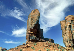
The Thumb - 1986
Navajo Loop Trail - 1986
| 24 Feb 2021 |
|
|
|
Bryce Canyon, begin of Navajo Loop Trail, near Sunset Point, before going down in the valley.
Red Canyon - Hoodoos - 1986
| 19 Feb 2021 |
|
|
|
Hoodoos along the Pink Ledge Trail in Red Canyon, Dixie National Forest, Utah. It's near the Bryce Canyon NP. - scanned slide, Minolta X700
Red Canyon - 1986
| 19 Feb 2021 |
|
|
|
Entering Bryce Canyon National Park from the Northwest on "Utah State Route 12", you first pass Red Canyon, which is a perfect attunement for the larger Bryce Canyon.
scanned slide, Minolta X700
Puerto del Hambre
| 16 Jan 2016 |
|
|
|
earth_layers
| 20 May 2015 |
|
|
|
all is eroding
| 20 May 2015 |
|
|
|
The high peak to the right is Pico Triangular Sud (2588 m), seen from Ruta 41.
marble_grotto
| 17 Apr 2015 |
|
|
|
rock_sensor
| 16 Apr 2015 |
|
|
all_eroded
| 16 Apr 2015 |
|
|
|
a bowl and a boat
Jump to top
RSS feed- Berny's latest photos with "erosion" - Photos
- ipernity © 2007-2025
- Help & Contact
|
Club news
|
About ipernity
|
History |
ipernity Club & Prices |
Guide of good conduct
Donate | Group guidelines | Privacy policy | Terms of use | Statutes | In memoria -
Facebook
Twitter


