Gipfel und Grate
Folder: Österreich
2962m - Top of Germany
| |
|
|
|
The summit of Zugspitze (Germany) at a sunny afternoon. You can reach it by cable car - or climbing on different routes. The most interesting one leads througt the Höllentalklamm.
Der Zugspitzgipel in der Nachmittagssonne. Man erreicht ihn mit der Seilbahn - oder kletternd auf verschiedenen Routen. Die interessanteste führt durch die Höllentalklamm.
Smile, Please!
| |
|
|
|
There isn't much space for the obligatory photo with the peak cross in the background.
Für das obligatorische Gipfelfoto ist nicht viel Platz.
Naturgewalten
| |
|
|
|
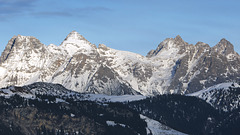
View from Gjadstein (2.794m, North Alps, Austria) direction south to the "Dachsteinmassiv". Left hand you see "Kleiner Gjadstein" (2.734m) and - in the very background - the upper station of the Dachstein-Cableway on the top of "Hunerkogel". In the middle you see "Die Dirndln" (2.818m). Right hand in the background is the "Hoher Dachstein" (2.995m). It's the top of "Dachstein-Massiv". Submontane you see several glaciers.
~~~~~
Blick vom Gjadstein (2.794m) nach Süden auf das Dachsteinmassiv.
Links vorne im Bild der kleine Gjadsten (2.734m), links im Hintergrund der Hunerkogel mit der Bergstation der Dachstein-Südwandbahn. In der Mitte die Dirndln (2.818m), und rechts der Hohe Dachstein (2.995m). Nach vorne (nördlich) breiten sich die diversen Dachsteingletscher aus.
On Top
| |
|
|
|
Gipfelkreuz des Tristkogel (2.095m, Kitzbüheler Alpen, Tirol) in der gleißenden Mittagssonne.
Top of Germany
| |
|
|
|
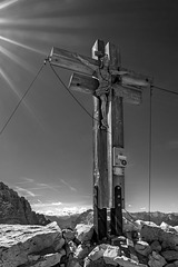
The summit cross of the Zugspitze (2962m, Bavaria, Germany). Close-up from northeast (directly from underneath the summit), where the ascension from the Höllental ends. (Picture from 2013, out of my archive.)
Das Gipfelkreuz der Zugspitze (2.962m). Close-Up von der Nordostseite (direkt unterhalb des Gipfels) wo der Weg vom Höllental hochkommt. (Archivbild vom August 2013.)
The history of this summit cross is very interesting: de.wikipedia.org/wiki/Zugspitze#Gipfelkreuz
So wie oben im Bild sehen es die ankommenden Kletterer:
Autumnial Dolomites
| |
|
|
|
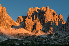
The Langkofel Group (Dolomites, Italy), captured one early mornig in September 2015, when the first hoarfrost happened. (The shadow in the foreground results from the Sella Mountains, reverse from the photographer.)
~~~~~
Die Langkofel-Gruppe in den Dolomiten, aufgenommen an einem frühen Septembermorgen 2015. Links die Grohmannspitze (3.126m), in der Mitte die Fünffingerspitze (2.996m), rechts der Langkofel (3.081m). Der Schatten im Vordergrund ist der des Sella-Massivs im Rücken des Fotografen.
~~~~~
View to the opposite direction:
Lake Pisciadù
| |
|
|
|
The Lake Pisciadù, situated very high (2,570m) within in the Sella Mountain Mass. Left hand the Cima Pisciadù (2,895m), which is amazingly easy to be climbed from the other side via a hiking trail - sufficient condition assumed.
~~~~~
Der Pisciadu-See, hoch oben (2.570 m) im Sella-Gerbirgsmassiv. Links der Pisciadu (2.895m), der erstaunlich einfach (hinten herum) über einen "Normalweg" zu besteigen ist - wenn man die nötige Kondition hat.
Rifugio F. Cavazza al Pisciadù
| |
|
|
|
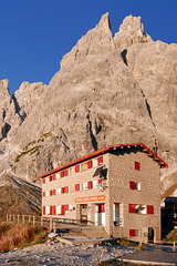
The Rifugio F. Cavazza al Pisciadù (2,587m, situated directly in front of the Cima Pisciadù) is a popular base for hiking-tours within the northeastern Sella Mountains. The Lago Pisciadù is situated directly behind the refugio. The season is very short there: from June, 21st, until September, 20th, only.
~~~~~
Das Rifugio auf 2.587m Seehöhe (am Fuße des Cima Pisciadù) ist ein beliebter Ausgangspunkt für Wanderungen im nordöstlichen Sella-Massiv. (Der Lago Pisciadù liegt direkt hinter der Hütte.) Die Saison dort oben ist kurz: 21. Juni - 20. September.
On Top - the Classical Version
| |
|
|
|
Ten hours after the start on top of the 'Ellmauer Halt' (2,344m). This is the highest summit of the 'Kaiser Mountains' (Tyrol, Austria).
~~~~~
Zehn Stunden nach dem Aufbruch auf dem Gipfel der Ellmauer Halt (2.344 m). Es ist der höchste Gipfel des gesamten Kaisergebirges (Nördliche Kalkalpen, Tirol).
~~~~~
Photographer: Another (unknown) climber.
On Top - the Artistic Version
| |
|
|
|
The summit cross of the 'Ellmauer Halt' (2344m, Kaiser Mountains, Austria).
~~~~~
Das Gipfelkreuz der Ellmauer Halt (2.344 m, Nördliche Kalkalpen, Tirol).
Monte Casale
| |
|
|
|
The summit, seen from the upper end of the Via Ferrata 'Che Guevara'. Up from here there is only a little "walk" of appromimately 150 meters.
~~~~~
Der Berggipfel, vom oberen Ende der Via Ferrata 'Che Guevara' her gesehen. Nun sind es nur noch rund 150 Meter.
Solitude ?
| |
|
|
|
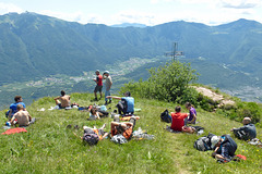
At high season you're never alone on the summits of the alps.
~~~~~
In der Hochsaison ist man in den Alpen auf kaum einem Gipfel allein.
~~~~~
After season:
Lofer Mountains
| |
|
|
|
Best on black / press 'z'
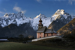
The Lofer Mountains, situated within the Northern Limestone Alps (Austria) - captured in the darkest time of the year, shortly after sunrise. Exactly behind the church spire you see the 'Reifhorn' (2.488m). Lefthand you see the 'Huge Ox Horn' (2.511m), which is the highest summit of those mountains. Righthand is the 'Breithorn' (2.415m).
In the middle of the saddle between 'Reifhorn' and 'Breithorn' the Schmidt-Zabierow-Hut is situated. In summertime it is the starting point for several hikes and climbing tours. However you have to ascend there completely by your own. There is no lift to carry you to the altitude of 1.966 meters.
~~~~~
Die Loferer Steinberge in den Nördlichen Kalkalpen (Bundesländer Tirol und Salzburg, Österreich) - in den dunkelsten Wochen des Jahres kurz nach Sonnenaufgang von Nordosten her fotografiert. Genau hinter der Kirchturmspitze ist das Reifhorn (2.488m) zu sehen. Links davon ist das große Ochsenhorn (2.511m, höchster Gipfel der Steinberge), rechts das Breithorn (2.415m).
Auf dem Sattel zwischen dem Reifhorn und dem Breithorn liegt auf 1.966m Seehöhe die Schmidt-Zabierow-Hütte des DAV Passau. Sommertags ist sie Ausgangspunkt für Wanderungen und Klettertouren in den Loferer Steinbergen. Allerdings muss man den ganzen Weg zu Fuß hoch. Lifte gibt es hier nämlich nicht.
~~~~~
Four weeks later:
Τ = Toleranz
| |
|
|
|
The double-cross on top of the 'Sextner Rotwandspitze" (2.965m, Dolomiti, Italy)
~~~~~
Das doppelte Gipfelkreuz auf der Sextner Rotwandspitze (2.965m, Dolomiten, Italien). Dieses Kreuz ist nicht nur ungewöhnlich aufwändig gestaltet, sondern zeichnet sich durch eine weitere Besonderheit aus: Es steht nämlich nicht auf dem Hauptgipfel der Sextner Rotwand, dem Vinatzer Turm (2.965m), sondern auf einem 30m niedrigerem Nebengipfel!
Kiss of the Morning Sun
| |
|
|
|
South-eastern view to the 'Sextner Rotwand' (Dolomiti, Italy), five minutes after sunrise. (Captured from a hill closeby to the Berti-Hut, 1.950m)
Left-hand in the background you see the 'Sentinella-Scharte'. There is a trail, which leads to the famous 'Tre Cime'. Prior to this detours the fixed rope route 'Via Ferrata Mario Zandonella', which leads to the summit of the 'Rotwandspitze.
~~~~~
Südostansicht der 'Sextner Rotwand' (Dolomiten, Südtirol) fünf Minuten nach Sonnenaufgang. (Aufgenommen von einem Hügel in der Nähe der Berti-Hütte, 1950m).
Hinten links im Bild die Sentinella-Scharte (2.717m Sattelhöhe), durch die ein Wanderweg zu den berühmen 'Drei Zinnen' führt. Kurz davor - im Schatten - zweigt nach rechts die 'Via Ferrata Mario Zandonella' ab, die von Süden her auf den Gipfel der Rotwandspitze führt.
~~~~~
The foto-point:
Lofer Mountains from the West
| |
|
|
|
Long distance view (~30 km) to the Lofer Mountains from the West. (Captured in the late afternoon from a mountain called "Astberg", situated near Oberndorf in Tyrol, Austria. Cutout of the original capture. Effective focal length = 310mm.) The prominent summit left-hand, which looks like a pyramid, is the Mitterhorn (2.506m). See PiP to identify the other summits.)
~~~~~
Blick auf die Loferer Steinberge aus großer Ferne (~30km) von Westen her. (Aufgenommen vom Astberg, Nähe Oberndorf in Tirol, an einem späten Nachmittag. Effektive Brennweite 310mm (Ausschnitt + Crop-Faktor). Der markante pyramidenförmige Gipfel links ist das Mitterhorn (2.506m). Übrige Gipfel siehe PiP.)
~~~~~
Ein Bild von der anderen Seite zeigt volker_hmbg :
www.ipernity.com/doc/564349/43946930
Mountaineers Rule #14
| |
|
|
|
Get acclimatised!
The Rifugio Antonio Bertti is a mountain-hut within the Dolomiti of Sexten. Situated on 1.950 meters, it's an ideal starting point for several hiking tours to the surroundig mountains. Behind the hut: the Monte Popera (3.045m)
(The day before we failed with our attempt to climb to the 'Sextner Rotwand' via the northern trail. More than 2.300 meters difference of altitude (within one only day) was beyond our's strength. We cancelled our primary plan, descended and hiked to this hut - at the same day with our last energy. Overnight we got acclimatised. The next day we enjoyed a wonderful sunrise and an easy climbing tour.)
~~~~~
Die Bertihütte ist eine Schutzhütte in den Sextner Dolomiten. Auf 1.950 m Höhe ist sie ein idealer Ausgangspunkt für Touren auf die umgebenden Berge. Im Hintergund der Monte Popera (3.045m).
(Tags zuvor scheiterten wir mit den Versuch einer nordseitigen Besteigung der Sextner Rotwand, weil uns die Höhendifferenz von über 2.300 Metern (an einem einzigen Tag) zu sehr zu schaffen machte. Deshalb sind wir wieder runter ins Tal und - noch am gleichen Abend - mit letzten Kräften zu dieser Hütte hoch, wo wir über Nacht ausreichend akklimatisieren konnten. Belohnt wurden wir am nächsten Tag mit einem wunderschönen Sonnenaufgang und einer spielend leichten Tour.)
~~~~~
The sunrise:
The Worlds Highest Accessible Summit Cross
| |
|
|
|
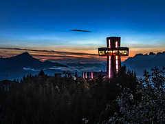
With an altitude of nearly 30 meters this summit cross is the highest accessible summit cross of the world. It's located in St. Jakob in Haus (Tyrol, Austria). Left-hand in the background you'll see the 'Kitzbüheler Horn.
~~~~~
Mit einer Höhe von fast 30 Metern ist das Jakobskreuz auf der Buchensteinwand in St. Jakob in Haus (Tirol) das größte begehbare Gipfelkreuz der Welt. Links im Hintergrund das Kitzbüheler Horn.
~~~~~
Further information:
de.wikipedia.org/wiki/Gipfelkreuz#Begehbares_Gipfelkreuz
~~~~~
Jump to top
RSS feed- Latest items - Subscribe to the latest items added to this album
- ipernity © 2007-2024
- Help & Contact
|
Club news
|
About ipernity
|
History |
ipernity Club & Prices |
Guide of good conduct
Donate | Group guidelines | Privacy policy | Terms of use | Statutes | In memoria -
Facebook
Twitter


