Earthwatcher's photos with the keyword: Cretaceous
Selwicks Bay panorama
| 27 Jul 2009 |
|
Disturbed Chalk in the Howardian Hills-Flamborough Fault belt at West Cliff, Selwicks Bay, Flamborough, East Yorkshire.
A panoramic stitching of 4 photos, using Canon's Photostitch software.
Disturbed Chalk stack at Selwicks Bay, Flamborough…
| 21 Jul 2009 |
|
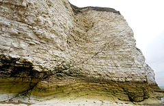
This Chalk (Upper Cretaceous, Burnham Formation) stack at West Cliff, Selwicks Bay, Flamborough, East Yorkshire, is severely deformed by folding and thrusting as part of the east-west trending Howardian Hills-Flamborough Fault belt, which is magnificently exposed in the northern part of Selwicks Bay.
Structures such as this are rare in the Chalk of northern England, but in the Flamborough area, these E-W belts of disturbed Chalk have been recognised since 1829 during the early years of geological surveying in the UK.
A comprehensive account of the structural geology of the Flamborough area is given in:
Starmer, I.C. 1995. Deformation of the Upper Cretaceous Chalk at Selwicks Bay, Flamborough Head, Yorkshire: its significance in the structural evolution of north-east England and the North Sea Basin. Proceedings of the Yorkshire Geological Society, vol 50, part 3, pp 213-228.
Includes superb maps, sections and 3D block diagrams - well worth a read.
Disturbed Chalk at Langtoft Quarry, East Yorkshire…
| 20 Jul 2009 |
|
Originally uploaded for the Guesswhere UK group.
This is a view of the old and rather overgrown Chalk quarry just south of Langtoft, in East Yorkshire.
Normally the Chalk in East Yorkshire is horizontally bedded or nearly so. But at this quarry the locally steep dips (> 50°) are due to the east-west trending Howardian Hills-Flamborough Fault belt. This is magnificently exposed on the coast at Selwicks Bay, near Flamborough Head:
In the Flamborough area, these E-W belts of disturbed Chalk have been recognised since 1829 during the early years of geological surveying in the UK.
Seatown Ridge Cliff
| 09 Apr 2009 |
|
Ridge Cliff, east of Seatown in Dorset, is capped by the golden Upper Greensand Formation (Cretaceous). This is in turn underlain by Lower Jurassic strata including the the paler yellow Bridport Sand seen here in the middle of the section.
The afternoon sun bathes everything in a golden light which together with the blue sky is intensified by a polarising filter.
Golden Boulders and Golden Cap
| 09 Apr 2009 |
|
Seaweed covered boulders at the foot of Ridge Cliff near Seatown, Dorset, England. Golden Cap in the background.
Seatown Ridge Cliff and beach
| 09 Apr 2009 |
|
Ridge Cliff, east of Seatown in Dorset, is capped by the golden Upper Greensand Formation (Cretaceous). This is in turn underlain by Lower Jurassic strata, including the Eype Clay at the base of the cliff. The latter is quite prone to landslides and mudflows.
The afternoon sun bathes everything in a golden light which together with the blue sky is intensified by a polarising filter.
To Seatown and Golden Cap
| 09 Apr 2009 |
|
Ridge Cliff, east of Seatown in Dorset, is capped by the golden Upper Greensand Formation (Cretaceous). This is in turn underlain by Lower Jurassic strata, including the Eype Clay at the base of the cliff. The latter is quite prone to landslides and mudflows.
Golden Cap, itself capped by Upper Greensand, is visible in the distance.
The afternoon sun bathes everything in a golden light which together with the blue sky is intensified by a polarising filter.
Seatown and Golden Cap
| 09 Apr 2009 |
|
View towards Golden Cap from Seatown, Dorset.
The pale yellow scar in the foreground is probably the Down Cliff Sands (Middle Lias, Lower Jurassic) and is a back scar of the extensive landslipped area to the left mainly in the Lower Lias shales (Eype Clay and Green Ammonite Beds).
Golden Cap exposes the Lower and Middle Lias sequence, overlain unconformably at the top by the yellow Upper Greensand (Cretaceous).
Seatown Yellow Ridge
| 09 Apr 2009 |
|
Ridge Cliff, east of Seatown in Dorset, is capped by the golden Upper Greensand Formation (Cretaceous).
The afternoon sun bathes everything in a golden light which together with the blue sky is intensified by a polarising filter.
Selwicks Bay faults
| 27 Jul 2009 |
|
Small faults cutting the Chalk at the north end of Selwicks Bay, Flamborough. The Chalk here is disturbed by the Howardian Hills-Flamborough fault belt, although this particular bit is not particularly deformed.
I also liked the colours and textures in the lower part of the cliff.
Molk Hole arch
| 27 Jul 2009 |
|
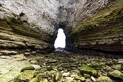
Molk Hole is an intriguing irregularly-shaped inlet at the north end of Selwicks Bay, Flamborough. A fascinating area of Chalk cliffs, sea caves and arches, hollowed out along fault and fracture zones in part of the Howardian Hills-Flamborough Fault Belt.
A lovely place to explore at low tide.
Molk Hole 1
| 27 Jul 2009 |
|
|
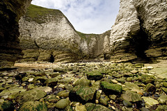
Molk Hole is an intriguing irregularly-shaped inlet at the north end of Selwicks Bay, Flamborough. A fascinating area of Chalk cliffs, sea caves and arches, hollowed out along fault and fracture zones in part of the Howardian Hills-Flamborough Fault Belt.
A lovely place to explore at low tide.
Molk Hole 2
| 27 Jul 2009 |
|
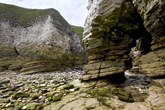
Molk Hole is an intriguing irregularly-shaped inlet at the north end of Selwicks Bay, Flamborough. A fascinating area of Chalk cliffs, sea caves and arches, hollowed out along fault and fracture zones in part of the Howardian Hills-Flamborough Fault Belt.
A lovely place to explore at low tide.
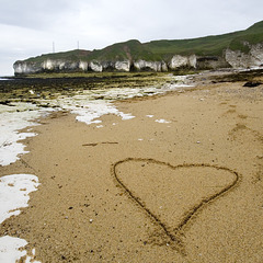
I Love Flamborough
| 27 Jul 2009 |
|
The title says it all really....
Selwicks, Bay, Flamborough, East Yorkshire.
Note the capping of brown glacial till ('boulder clay') overlying the Chalk cliffs.
Whitlands Cliff, East Devon
| 21 Mar 2009 |
|
This is located next to the South West Coast Path which runs through the Axmouth to Lyme Regis Undercliff National Nature Reserve, a conservation area of international importance. This is an area of extensive landslides which have created a jumble of ridges and chasms, now the location of luxurious woodland and special habitats for plants, birds, insects and other animals.
The rock in the landslip back scar is the Upper Greensand Formation (Cretaceous).
The Spittles landslide west
| 07 Apr 2009 |
|
The Spittles landslide area near Charmouth, Dorset, looking west towards Lyme Regis.
The Spittles is a wilderness of extensive, active, multiple landslides in Lower Lias (Lower Jurassic) shales, overlain by the Upper Greensand (Cretaceous) which forms the inland golden cliff to the right.
Panorama stitched manually from 2 wide-angle photos.
Seatown west cliffs
| 09 Apr 2009 |
|
Just west of Seatown, Dorset. Low cliffs of landslipped Lower Lias shales (the 'Green Ammonite Beds', lower Jurassic) with mudflows. The bedding in these cliffs is completely disrupted by the landslides. None of it is in its original place.
Golden Cap in the background with its yellow capping of Upper Greensand.
The Spittles landslide east
| 08 Apr 2009 |
|
Another view of The Spittles landslide near Charmouth, Dorset, this time looking east. Golden Cap is visible on the distant skyline.
The Spittles is a wilderness of extensive, active, multiple landslides in Lower Lias (Lower Jurassic) shales, overlain by the Upper Greensand (Cretaceous) which forms the inland golden cliff to the leftt.
In the foreground is a recent rotational landslide. The sloping grassy surface in the foreground was originally horizontal and level with the grass on the left. This section has slipped downwards and rotated anticlockwise. The yellow sand cliff in the left foreground is the landslide back scar.
Panorama stitched manually from 2 wide-angle photos.
Jump to top
RSS feed- Earthwatcher's latest photos with "Cretaceous" - Photos
- ipernity © 2007-2025
- Help & Contact
|
Club news
|
About ipernity
|
History |
ipernity Club & Prices |
Guide of good conduct
Donate | Group guidelines | Privacy policy | Terms of use | Statutes | In memoria -
Facebook
Twitter


