slgwv's photos with the keyword: Columbia Basin
The Artificial River
| 19 Sep 2015 |
|
|
|
Main distribution channel for the Columbia Basin (irrigation) Project. Water pumped up from the Columbia River is released from Banks Lake, the storage reservoir, to head south, in many cases using existing Scabland channels left by Ice Age floods. Washington state, USA.
Potholes Coulee
| 25 Aug 2015 |
|
|
|
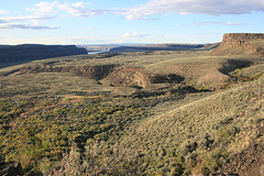
And one of the Ancient Lakes, in the wildlife area of the same name. Looking west out the coulee. Washington state, USA. The lakes are natural but their level has risen considerably since construction of the Columbia Basin irrigation project.
Ancient Lakes
| 25 Aug 2015 |
|
|
|
In the wildlife area of the same name, in Potholes Coulee, Washington state. The lake basins are natural but the water level has been raised considerably since the construction of the Columbia Basin irrigation project, on the plateau above, which has raised the water table. (Trees at a farmhouse in the irrigated area are visible on the skyline at the left.) So the area is not so remote as it appears!
(And if you're wondering why the same area is a "plateau" and a "basin"--well, it's all in your perspective! ;)
Babcock Bench
| 23 May 2014 |
|
|
|
Looking north from the trail below Cave B Resort, Washington State, USA. The Columbia River is just visible to left of center.
Summer Falls
| 22 May 2014 |
|
|
|
Washington state, USA. A human-created waterfall in the middle of the Columbia Basin, where irrigation water distributed from Banks Lake falls into Billy Clapp Lake. For many years the falls just fell freely, but in the 80s a small hydropower plant was built to recover most of the energy. So now it's purely the "esthetic overflow." In the album there are a couple of underexposed pix from the 80s where the larger falls volume is obvious.
Column Wall
| 22 Nov 2010 |
|
Columnar jointing at the base of a Columbia River Basalt flow exhumed by the Scabland floods.
Plunge Pool
Frenchman Coulee
| 22 Nov 2010 |
|
Looking out the coulee to the southwest on a bleak winter day. Note my vehicle (outlined); in those days you could drive on the jeep roads in the coulee!
Weathered Boulder
| 22 Nov 2010 |
|
In the outwash debris below Sentinel Gap, somewhere in the Priest Rapids wildlife area. This boulder has lain there for >10^4 years now, and is somewhat worse for wear! Beer can for scale. Note how some of the original surface is preserved at the lower right.
Waterfall into Frenchman Coulee.
| 22 Nov 2010 |
|
With the raising of the water table by the Columbia Basin Project in the mid-20th century, lots of quasi-perennial streams now flow across the basin, and this one finds its way into the coulee.
Jump to top
RSS feed- slgwv's latest photos with "Columbia Basin" - Photos
- ipernity © 2007-2024
- Help & Contact
|
Club news
|
About ipernity
|
History |
ipernity Club & Prices |
Guide of good conduct
Donate | Group guidelines | Privacy policy | Terms of use | Statutes | In memoria -
Facebook
Twitter


