Crop Irrigation Circles
Circular Stairway
Texas State Capitol Extension
Mission San Francisco de la Espada
Waffle, Texas Style
Flowers
Wildflowers
Wildflowers
Wildflowers
Wildflowers
Wildflowers
Barn Swallow Nestlings
Black Bellied Whistling Duck
Black Bellied Whistling Duck
Duck Feet Reflected
Duck Grooming
Antherium
Uncarina Roesaliana
Opuntia Flower
Hesperaloe Flowers
Hesperaloe Flowers
San Antonio Botanical Garden
Sunflower
Door to the Victorian Room in the Driskill Hotel
Carpet in the Texas State Capitol Building
Flooring in the Agricultural Museum
Flooring in the Agricultural Museum
See also...
Keywords
Authorizations, license
-
Visible by: Everyone -
All rights reserved
-
260 visits
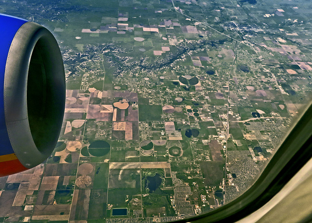
Aerial View - Randall County, Texas


At the lower right is Amarillo, Texas. The airport between the developments on the lower right is Tradewind Airport. The lake at the bottom center is in Southeast Park. The airport on the upper left in front of the engine is River Falls Airport. The lake above and to the right of the airport is Lake Tanglewood formed by the damming of Palo Duro Creek. The canyon top center is Timbercreek Canyon. The diagonal highway upper right is Interstate 27. (IMG_4867)
ROL/Photo, Eunice Perkins, Pam J have particularly liked this photo
- Keyboard shortcuts:
Jump to top
RSS feed- Latest comments - Subscribe to the comment feeds of this photo
- ipernity © 2007-2025
- Help & Contact
|
Club news
|
About ipernity
|
History |
ipernity Club & Prices |
Guide of good conduct
Donate | Group guidelines | Privacy policy | Terms of use | Statutes | In memoria -
Facebook
Twitter

I love to see the land from the air !
Congrats on Explore.
the same photo
Sign-in to write a comment.