Sunset on a rainy day (240°)
Raps und Wolken - Rapeseed and clouds (015°)
Tuolumne Meadows, Yosemite NP, 1986 (090°)
Owens Valley and High Sierra near Manzanar, Febr.…
Shrine of the Book and Knesseth, Jerusalem, 1975 (…
Ocean at Montana, Santa Monica, 1985 (135°)
Singapore Skyline, 1995 (210°)
Gear Down - C17 Globemaster approaching Ramstein A…
Flotter Dreier - Junkyard
The Duel, reloaded? - Mirror Image Somewhere on I…
Der Kaiserdom zu Speyer - Mittelschiff
Endlich fertig ? - Elbphilharmonie mit Außenfahrst…
Dunkle Wolken über Bankfurt - Dark clouds looming…
Somewhere in Yosemite NP, Fall 1985 (060°)
Into Saline Valley, March 1980 (300°)
Waterkant von Steinwerder bei Nacht (015°)
Heidelberg zur Blauen Stunde - Blue Hour over Heid…
Mosbacher Budenzauber (000°)
El Capitan, Yosemite NP, Oct. 1986 (060°)
Hiding in the clouds - Mt. Rainier from Reflection…
Hiking to Hanauer Hütte - Auf dem Weg zur Hanauer…
Alabama Hills and High Sierra near Lone Pine, Ca,…
Entering Death Valley the unusual way via Hunter M…
Kraftwerk Heilbronn - Heilbronn Power Plant (135°)
Tioga Lake, 1979 (180°)
Rickmer Rickmers
Gundelsheim mit Burg Horneck (015°)
Winterabend (165°)
Wintermorgen (165°)
Tenaya Lake, Yosemite NP, 1980 (045°)
Beam me up, Scotty ;-) (075°)
Zwingenberg am Neckar (330°)
Fallobst (240°)
Red and Black / Große Koalition ;-)
Demon's Eye
Blue Fluid
Herbstmorgen - A milky morning sun (165°)
How High The Moon - Heimspiel (330°)
White Beauty
100 Peaks - 100 Gipfel
Spring - Frühlingshimmel (090°)
Exploding Sky - Wolkenexplosion (165°)
Kirchgang (330°)
Hamburg, Rathaus und Kleine Alster bei "Schiedwedd…
Neckarbrücke bei Zwingenberg (345°)
Location
Lat, Lng:
You can copy the above to your favourite mapping app.
Address: unknown
You can copy the above to your favourite mapping app.
Address: unknown
See also...
Keywords
Authorizations, license
-
Visible by: Everyone -
All rights reserved
-
788 visits
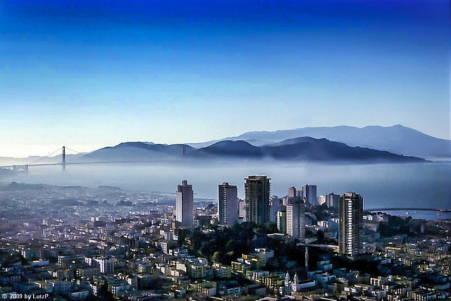
Happy Hour - View from Carnelian Room, BoA Building, 1978 (300°)


Russian Hill, Golden Gate, Marin Headlands and Mt. Tam in the distance (slide scan)
Berny, Uli F., William Sutherland and 2 other people have particularly liked this photo
- Keyboard shortcuts:
Jump to top
RSS feed- Latest comments - Subscribe to the comment feeds of this photo
- ipernity © 2007-2025
- Help & Contact
|
Club news
|
About ipernity
|
History |
ipernity Club & Prices |
Guide of good conduct
Donate | Group guidelines | Privacy policy | Terms of use | Statutes | In memoria -
Facebook
Twitter

LutzP club has replied to Berny clubAdmired in:
www.ipernity.com/group/tolerance
LutzP club has replied to William Sutherland clubLutzP club has replied to Uli F. clubRussian Hill ist richtig, aber es ist die North Bay Church am Broadway (eigentlich Nuestra Senora de Guadelupe). Heute ist das keine Kirche mehr. Russische Invertoren haben das Gebäude gekauft und nutzen es als Event Location. Der Washington Square ist rechts außerhalb des Bildes.
Stimmt, dass die zusammengeklebten Panoramen nicht so gut waren, aber gerade in diesem Fall erhält man gut den Eindruck von dem Blick, den man vom Carnelian Room aus hat. Mein "Panorama" reicht von einem Teil des Presidio, Fort Point, Russian Hill, Alcatraz, Telegraph Hill bis zum Pier 31. Diese Fotos sind nun fast 40 Jahre alt, und da es sich um "Abzüge" von Diapositiven handelt, werde ich sie noch einmal scannen. Nach meinen Erfahrungen sind Dias bedeutend besser erhalten als Papierfotos.
Wir waren übrigens am 30. Juni 1978 dort oben - vielleicht haben wir uns dort getroffen ;-)???
Sign-in to write a comment.