Clouds and Weather
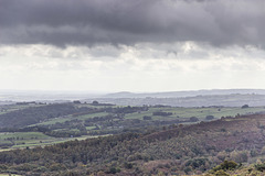
Rain over Millstone Edge and the Derwent valley
| |
|
|
|
A wet and blustery day, with rain and low clouds driven on a strong westerly wind, scudding over the gritstone edges at the eastern side of the Peak District National Park.
The prominent escarpment edge in the centre is Millstone Edge, comprised of the Chatsworth Grit (Namurian age), partly quarried in the past for millstones and grindstones, hence its name. Now popular with climbers. The rocky tor on the left is Over Owler Tor.
Not really a day to be out and about on the moors. I took this from the shelter of my car!
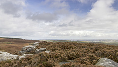
View north-east over Houndkirk Moor from the shelt…
| |
|
|
|
A walk on Houndkirk Moor 19
A cool morning with frequent showers, clearing to sunshine by afternoon.
A view north-east from the stone shelter in the previous photo, over the wide expanse of Houndkirk Moor. To the left of centre in the middle distance is Houndkirk Hill. The rocks to the right of centre form Houndkirk Edge. The straight scarp edge marks the line of a fault which runs along the foot of the scarp in a NE-SW direction.
Both scarps are composed of Namurian age ('Millstone Grit Series') Chatsworth Grit
Summit of Houndkirk Hill looking south
| |
|
A walk on Houndkirk Moor 13
A cool morning with frequent showers, clearing to sunshine by afternoon.
Another shower sweeps in from the west, partly obscuring this southerly view from the summit of Houndkirk Hill.
The dark hill in the centre is near Cocking Tor just south-west of Ashover, some 13 miles away.
Summit of Houndkirk Hill looking NE
| |
|
A walk on Houndkirk Moor 12
A cool morning with frequent showers, clearing to sunshine by afternoon.
A north-easterly view from the from the summit of Houndkirk Hill. The rocks are Namurian-age ('Millstone Grit Series') Chatsworth Grit. The eastern side slopes gently down towards the A625 Hathersage Road and Dore beyond.
Sheffield is visible in the far distance.
Spurn lighthouses view NE
| |
|
|
|
A visit to Spurn Point 22
There are two lighthouses on Spurn; the newer 'High Lighthouse', painted black and white, was built 1893-95; the older 'Low Lighthouse' is visible on the left.
The Lower Lighthouse', was built by engineer John Smeaton and completed in 1776. But by 1892, the structure was becoming cracked and unstable, and the new 'Upper Lighthouse' was constructed to replace Smeaton's light.
The black cylinder on the top of the Lower Lighthouse is a water tank, which has replaced the former lantern turret.
Spurn Warren view SW to lighthouses
| |
|
|
A visit to Spurn Point 15
The southern part of Spurn widens into the grassy sand banks of Spurn Warren. There are two lighthouses on Spurn; the newer 'High Lighthouse', painted black and white, was built 1893-95; the older 'Low Lighthouse' is visible to the right of centre.
More details here:
historicengland.org.uk/listing/the-list/list-entry/1083476
The High Lighthouse was taken out of service in 1985 and is now managed and opened for visitors by the Yorkshire Wildlife Trust.
Spurn Warren view NE
| |
|
|
|
A visit to Spurn Point 14
A view north-east from the grassy sand banks of Spurn Warren.
Spurn Chalk Bank view north 1
| |
|
A visit to Spurn Point 11
The western side of Spurn overlooks the salt marsh and mud flats: a haven for wading and migrating birds, which flock here to feed.
The white Chalk boulders originate from barge-loads of Chalk emplaced on the west side of the spit during the period 1851 - 1857 following a series of storm surge breaches.
Midnight clouds and stars
| |
|
|
|
Nearly midnight in south-west Sheffield and there were some lovely altocumulus clouds drifting along, partly illuminated by a nearly full moon (out of shot to the right). The view direction is to the east-south-east. The constellation of Cassiopeia is just to the left of centre.
A six-second exposure caused the clouds to blur a little bit, but the stars were sharp. Some exposure adjustment and noise reduction made using Affinity Photo software.
Best viewed large to see the stars properly.
Altocumulus with fallstreaks
| |
|
|
Some rather nice altocumulus clouds with fallstreaks, formed during the afternoon on 19th July 2020, viewed from south-west Sheffield.
Barafundle Bay cloudscape from Stackpole Head
| |
|
|
|
Broad Haven (south) to Stackpole Head
Viewed from Stackpole Head, cloud-streets of cumulus set off the land and seascape looking towards Barafundle bay just left of centre. To the right, the light grey Carboniferous Limestone gives way to cliffs of 'Old Red Sandstone'.
Box Bay panorama
| |
|
|
|
Broad Haven (south) to Stackpole Head
Just east of Broad Haven and Saddle Point is Box Bay with well developed sea-caves at its eastern end. Can you see the climbers? The rocks are Carboniferous Limestone.
Box Bay is sometimes known as Sandy Pit Bay (after the doline just inland of the bay). Neither names are used on the Ordnance Survey maps.
The headlands of Mowingword and Stackpole Head are at the far right.
This is a panoramic view consisting of two landscape photos sticthed together using Photshop software. Also taken using a polarising filter. I'm pleased with how the clouds have turned out.
Freshwater West walkies
| |
|
|
Freshwater West, Gravel Bay and East Pickard Bay
It was rather a dull morning, with a moody sky over the broad sweep of Freshwater West in south Pembrokeshire, viewed from Gravel Bay. This couple and their dog came along at just the right moment.
Spray haze over Freshwater West
| |
|
|
Freshwater West, Gravel Bay and East Pickard Bay
It was rather a dull morning, with a moody sky over the beach at low tide. This is looking south from Gravel Bay at the northern end of the broad sweep of Freshwater West in south Pembrokeshire. A beach-hugging haze of spray adds to the minimalist softness of the scene.
Moody sky over Freshwater West
| |
|
|
|
Freshwater West, Gravel Bay and East Pickard Bay
Although it was a dull morning, with a moody sky over the beach at low tide, I rather liked this minimalist shoreline view. This is looking south from Gravel Bay at the northern end of the broad sweep of Freshwater West in south Pembrokeshire.
Raasay: Morning view over Churchton Bay to Skye
| |
|
|
|
It was a beautiful, calm, and sunny April morning on Raasay. The view over Churchton Bay to the Cuillins on Skye was lovely.
The nearer mountain left of centre is Glamaig, part of the Red Cuillins; the Black Cuillins are in the distance to the right of centre. The faithful Raasay ferry is visible below Glamaig on its first early morning run to Sconser.
Tenby North Sands skyscape from Castle Hill 2
Ben Stack: view north-east towards Arkle
| |
|
A windy, blusterous day on Ben Stack (15)
Descending from Ben Stack, at the bealach of Coire nam Mang, a final view of the dramatic south-west flank of Arkle. The main bulk of Arkle is comprised of south-easterly dipping, pale grey Cambrian quartzites of the Ardvreck Group, which lie with great unconformity over the Lewisian Gneiss visible in the lower part of the photo.
Jump to top
RSS feed- Latest items - Subscribe to the latest items added to this album
- ipernity © 2007-2025
- Help & Contact
|
Club news
|
About ipernity
|
History |
ipernity Club & Prices |
Guide of good conduct
Donate | Group guidelines | Privacy policy | Terms of use | Statutes | In memoria -
Facebook
Twitter


