England - Rural North Yorkshire
Folder: Yorkshire
This, the largest of Yorkshire's four counties – and the largest county in England – is also the most beautiful. Unlike the rest of northern England, it has survived almost unscathed by the Industrial Revolution. Since the Middle Ages, North Yorkshire has been almost exclusively about sheep and the woolly wealth they produce.
Rather than closed-down factories, mills and mines, the man-made monumen… (read more)
Rather than closed-down factories, mills and mines, the man-made monumen… (read more)
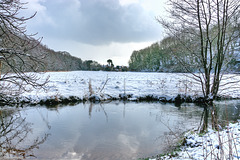
Riverside trees reflected on the Derwent - North Y…
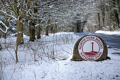
National Park boundary marker - Forge Valley
| |
|
|
|
The North York Moors, also referred to as the Yorkshire Moors, is an upland area in north-eastern Yorkshire, England. The moorland contain one of the largest expanses of heather in the United Kingdom. The area was designated as a National Park in 1952, through the National Parks and Access to the Countryside Act 1949. Covering an area of 554 sq mi (1,430 km2), the park also has a population of 23,380. It is administered by the North York Moors National Park Authority, whose head office is based in Helmsley
Forge Valley is a National Nature Reserve in the Scarborough district of North Yorkshire, England, located within the North York Moors National Park on the East Ayton / Hackness road. The valley follows the route of the River Derwent and was formed by melting ice water at the end of the last ice age. The NNR at Forge Valley covers over 63 hectares (160 acres).
Distant East Ayton over the Derwent - Forge Valley
| |
|
|
|
The view is over the river Derwent towards the village of East Ayton at the southern end of the vallely. The woods on both sides continue along the full length of the valley.
Forge Valley is a National Nature Reserve in the Scarborough district of North Yorkshire, England, located within the North York Moors National Park on the East Ayton / Hackness road. The valley follows the route of the River Derwent and was formed by melting ice water at the end of the last ice age. The NNR at Forge Valley covers over 63 hectares (160 acres).
The area is now covered with woodlands which are thought to be 6,000 years old. Forge Valley takes its name from the charcoal that was made in these woods for iron forges. There was a foundry to the north of the valley in 1798.
The field on the other side of the river is normally occupied by sheep or cattle in the spring and summer. At times of high water it acts as a flood plain when the water bursts the banks of the river, as was the case a few weeks ago.
On the banks of the Derwent in Winter (Forge Valle…
| |
|
|
|
The River *Derwent in North Yorkshire flows for 72 ml/115 km from it’s source at Lilla Rig on Fylingdales Moor, approximately 6 ml/9.6 km from the North Sea. The picture was taken 15 ml/21 km downstream of Lilla Rig. The river go on until it meets with the River Ouse at Barmby Barrage at Barmby on the Marsh.
Before the ice age the Derwent entered the sea at Scalby, near Scarborough. But a tongue of ice and then glacial deposits blocked its outflow and, together with the Rye, the two rivers formed a lake in the Vale of Pickering. After time an outlet formed at Kirkham gorge and the water flowed south to join the Ouse.
The river flows through the five hundred and fifty four square mile of North Yorkshire Moors National Park, the low lying Forge Valley, Vale of Pickering and Vale of York and through the hills of Kirkham Gorge and the Yorkshire Wold.
The river passes through several Yorkshire villages, including East and West Ayton, Stamford Bridge, which is the historical site of the 1066 Battle of Stamford Bridge (Saxons v Vikings), and market towns of Malton and Pickering.
The name Derwent was recorded by Bede in the 8th century as Deruuentionis fluvii , from the Celtic “river where oak trees grow abundantly.”
*Note: The Yorkshire river Derwent is one of four rivers in England with the name Derwent. The others are:
Cumbria - 60 ml/96 km
Derbyshire - 60 ml/96 km
Northumbria - 35 ml/56 km
All distances approximate
Winter Gate
All Saints Church, Wykeham, North Yorkshire
| |
|
|
|
Built by William Butterfield in 1853 All Saints Church is in the medieval style of the late 13th century. It is unusual in as much as the Tower, dedicated to St Helen, stands separated from the church. This was part of the older 14th century tower of an earlier medieval church. The spire was added by Butterfield and the tower is effectively a majestic gateway to the present Victorian church.
HFF from Wykeham
| |
|
|
|
The 'ICE HOUSE' sign points the way to the 18th century Ice House (see below).
Woodland Snowdrops
Snowdrop Woodland - Wykeham, North Yorkshire
Wykeham Ice House - North Yorkshire (HFF everyone)
| |
|
|
|
The 18th century Ice House, near Fishpond Wood, was restored as part of the Wykeham and Ruston Millennium Project.
A brick arch/dome the size of a double-decker bus half buried into an earth bank and underneath, continuing the brick, a deep "egg shaped chamber". The ice would have been collected from the pond or brought in by train after a mild winter, and then covered with straw. It is now a grade II listed building.
Winter Shadows - Wykeham Forest, North Yorkshire
Sunny Winter Day, Wykeham Forest, North Yorkshire
Winter Robin, Wykeham Forest, North Yorkshire
Cow Parsley Dressed for Winter
| |
|
|
|
Brambles in Winter
Little and large
| |
|
|
|
Stand firm lads and lassies, we have him outnumber…
| |
|
|
|
Chilly winter dawn, Scarborough, North Yorkshire
Jump to top
RSS feed- Latest items - Subscribe to the latest items added to this album
- ipernity © 2007-2024
- Help & Contact
|
Club news
|
About ipernity
|
History |
ipernity Club & Prices |
Guide of good conduct
Donate | Group guidelines | Privacy policy | Terms of use | Statutes | In memoria -
Facebook
Twitter


