See also...
Keywords
Authorizations, license
-
Visible by: Everyone -
All rights reserved
-
92 visits
Belden 01


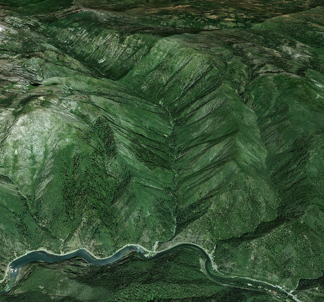
This Google Earth image shows the Pacific Crest Trail route from Belden, CA in the lower right to Frog Mountain in the upper left, high on the right side of Chips Creek Canyon. I've been intrigued by this big canyon that separates from the larger Feather River Canyon for years. I lived in this area as a teen and never knew it existed until using Google Earth, and after looking at USGS quad sheets, realized the PCT runs right up it. 28 mile round trip with 4,800 ft elevation gains.
- Keyboard shortcuts:
Jump to top
RSS feed- Latest comments - Subscribe to the comment feeds of this photo
- ipernity © 2007-2024
- Help & Contact
|
Club news
|
About ipernity
|
History |
ipernity Club & Prices |
Guide of good conduct
Donate | Group guidelines | Privacy policy | Terms of use | Statutes | In memoria -
Facebook
Twitter

Sign-in to write a comment.