The Trollfjord
Harbour view
Back to Bergen
evening light
Down the fjord
Here comes the mail!
Through the mountains
On the Clyde
Bridge at night
Vigeland
Opera in Oslo
Oslo park
What next?
Selfie time!
Fire glow
Smoky Jacarandas
Fires nearby
It's cooler there
Beach visit
And as the sun sets ...
Fire coming
In the thick of the smoke
What a @#$% year!
Another bridge
Canyon of the Grande Ronde
The Bow to the west
Ummm!
Lofoten view
Lisa
From the Arctic Cathedral
Dopey animal!
Park, playground and fences
Hammerfest
The wind picked up
Havoysund morning
Vardohus Fortress
"Trollfjord" at Kirkenes
Beach gymnastics
Congo Beach #2
Congo Beach #1
Sea ice
The mast
Beach - southward
Ships in the snow
After Tromso
Location
Lat, Lng:
You can copy the above to your favourite mapping app.
Address: unknown
You can copy the above to your favourite mapping app.
Address: unknown
See also...
Keywords
Authorizations, license
-
Visible by: Everyone -
All rights reserved
-
600 visits
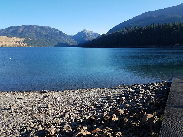
Wallowa Lake


From the boat ramp (visible to right) at the north end of the lake. The triangular mountain in the middle is actually the cross-sectional profile of the ridge separating the East (to the left) and West Forks of the Wallowa River. Mt. Howard, the location of the tramway, is on the left.
Wallowa Lake is a glacial lake, about 300 ft (90 m) deep in the middle, whose level has been raised slightly by a small outlet dam for water storage, as is common throughout the American west. A prominent lateral moraine extends along the east side of the lake. Its upstream end is visible at the extreme left; the inset shows a more extensive view.
Again, it's "wuhl-OW-uh," "OW" as in "town."
William Sutherland, Pam J have particularly liked this photo
- Keyboard shortcuts:
Jump to top
RSS feed- Latest comments - Subscribe to the comment feeds of this photo
- ipernity © 2007-2024
- Help & Contact
|
Club news
|
About ipernity
|
History |
ipernity Club & Prices |
Guide of good conduct
Donate | Group guidelines | Privacy policy | Terms of use | Statutes | In memoria -
Facebook
Twitter

Admired in:
www.ipernity.com/group/tolerance
Sign-in to write a comment.