Blaueis-Gletscher
Folder: Österreich
H.A.N.W.E. at Hintersee (Bavaria)
Yesterday morning on the way to the glacier Blaueis above the lake Hintersee near Ramsau (Bavaria, Germany).
~~~~~
Gestern morgen auf dem Weg zum Blaueisgletscher oberhalb des Hintersees bei Ramsau (Bayern).
~~~~~
(Beginn der Tour)
Twice Two
Yesterday morning at the western shore of lake Hintersee near Ramsau (Bavaria, Germany).
~~~~~
Gestern morgen am Westufer des Hintersees bei Ramsau (Bayern).
~~~~~
(Der See etwas später von oben aufgenommen)
Bike & Hike
In terms of altitude, the savings are often not great. Here it was only 160 meters (from 790 to 950) until the forest road was closed for mountain bikers. But for the 6 km distance to the car park the bike was a huge relief, especially on the way back. (Captured at lake Hintersee near Ramsau (Bavaria, Gemany).
~~~~~
Bei den Höhenmetern ist die Ersparnis oft nicht groß. Hier waren es nur 160 Höhenmeter (von 790 auf 950), bis der Forstweg für Mountainbiker gesperrt war. Danach ging es nur noch zu Fuß weiter. Aber für die 6 km Entfernung zum PKW-Parkplatz war das Rad vor allem beim Rückweg eine riesige Erleichterung. (Aufgenommen am Hintersee bei Ramsau (Bayern).
~~~~~
Our goal / unser Ziel:
(Der Blaueis-Gletscher)
Dead Ice (2)
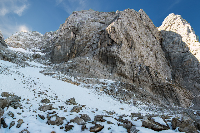
The Blue Ice Glacier in the Berchtesgaden Alps (Bavaria, Germany), captured from the lower end of the dead ice field at about 1,900 m above sea level.
~~~~~
Der Blaueis-Gletscher in den Berchtesgadener Alpen (Bayern), aufgenommen vom unteren Ende des Toteis-Feldes auf ca. 1.900 m Seehöhe.
~~~~~
(4 Stunden zuvor vom Tal her aufgenommen)
Dead Ice (1)
The Blue Ice Glacier in the Berchtesgaden Alps (Bavaria, Germany), captured from the lower end of the dead ice field at about 1,900 m above sea level.
~~~~~
Der Blaueis-Gletscher in den Berchtesgadener Alpen (Bayern), aufgenommen vom unteren Ende des Toteis-Feldes auf ca. 1.900 m Seehöhe.
~~~~~
Glacier "Blaueis"
View from lake Hintersee (Ramsau, Bavaria, Germany) to the Hochkalter with the underlying poor rest of the northernmost glacier of the Alps, the Blaueis-Gletscher .
Information about the dramatic glacier shrinkage and a picture from 1985: de.wikipedia.org/wiki/Blaueis
~~~~~
Blick vom Hintersee (Ramsau, Bayern) auf den Hochkalter mit dem darunter liegenden kümmerlichen Rest des nördlichsten Gletschers der Alpen, dem Blaueis-Gletscher .
Informationen über den dramatischen Gletscherschwund und ein Vergleichsbild von 1985: de.wikipedia.org/wiki/Blaueis
~~~~~
(Morgenstimmung am Hintersee)
A "Standard Path"
While the Blaueisspitze and the Hochkalter require mountaineering skills, the neighbouring Schärtenspitze (2.153m) is relatively easily accessible. Here we just met a descending hiker.
~~~~~
Während die Blaueisspitze und der Hochkalter bergsteigerisches Können erfordern, ist die benachbarte Schärtenspitze (2.153m) relativ leicht zugänglich. Hier begegnete uns gerade ein absteigender Wanderer.
www.outdooractive.com/de/bergtour/berchtesgadener-land/schaertenspitze-aufstieg-ueber-blaueishuette-abstieg-ueber-hochalm-/9173531
Blaueis Hut
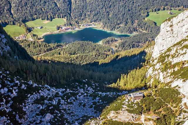
View back into the valley when climbing the Schärtenspitze (2.153m). On the lower right in the picture the famous Blaueis-Hütte (1.651m) with the beautiful sun terrace. Here one should absolutely stop and treat oneself to a piece of homemade cake.
~~~~~
Blick zurück ins Tal beim Aufstieg auf die Schärtenspitze (2.153m). Rechts unten im Bild die berühmte Blaueis-Hütte (1.651m) mit der schönen Sonnenterrasse. Hier sollte man unbedingt einkehren und sich ein Stück hausgemachten Kuchen gönnen.
~~~~~
Hüttenportrait von SERVUS TV (4:46 min):
www.servus.com/at/p/Blaueish%C3%BCtte/1343227636231-2071391747
~~~~~
(The Way up)
Watzmann
View of the Watzmannmassiv when climbing the Schärtenspitze (2,153m). Directly behind my wife it goes down 500 meters vertically into Wimbachtal . (Super WW effect by combination of 9 single shots.)
~~~~~
Blick auf das Watzmannmassiv beim Aufstieg auf die Schärtenspitze (2.153m). Direkt hinter meiner Frau geht es 400 Meter senkrecht runter ins Wimbachtal . (Super-WW-Effekt durch Kombination von 9 Einzelaufnahmen.)
Jump to top
RSS feed- Latest items - Subscribe to the latest items added to this album
- ipernity © 2007-2024
- Help & Contact
|
Club news
|
About ipernity
|
History |
ipernity Club & Prices |
Guide of good conduct
Donate | Group guidelines | Privacy policy | Terms of use | Statutes | In memoria -
Facebook
Twitter


